ArcGIS Online has been updated as of the start of 2019. The last update to ArcGIS Online now includes some of the following new features and enhancements:
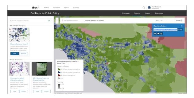
- Esri Maps for Public Policy – This is a FREE resource for policy makers to actively engage in community decision making. Powered by the Living Atlas, communities now have access to pre-authored maps from curate datasets that can be used to learn more about social equity and health, economic opportunity, transportation and infrastructure, resilience and sustainability, environment and natural resources, and public safety. To learn more about Esri Maps for Public Policy, go here.
- New user type licensing model – User types replace member levels use ArcGIS Online capabilities and apps. Administrators can now assign user types with associated privileges and apps to better align with your organization and the needs of your members. To learn more about user types, go here and here or watch the ArcGIS User Type Video Tour.
- Living Atlas – ArcGIS Living Atlas of the World is the foremost collection of geographic information from around the world. New in Living Atlas are:
The Reference Elevation Model of Antartica (REMA) – This is an 8-meter resolution elevation model covering Antarctica. It is the latest addition to Esri’s polar elevation services, adding a level of detail not previously available before. Use the Antarctic REMA Explorer to explore and visualize the layers.
The aforementioned features are just a few of the many new features of ArcGIS Online. To learn more about what’s new in ArcGIS Online, read Esri’s Bern Szukalski’s blog – What’s New In ArcGIS Online – or see the What’s New Help Topic or view all posts related to the latest ArcGIS Online release.