The largest release of ArcGIS Pro early this year – ArcGIS Pro 2.3 – carries with it more new and updated imagery and remote sensing capabilities.
Some of the new imagery and remote sensing-related features in ArcGIS Pro 2.3 are:
- ArcGIS Cloud Storage Connection Files – This allows you to connect to cloud stores – AWS, Azure, Alibaba - directly, browse buckets/folders and access imagery in your project.
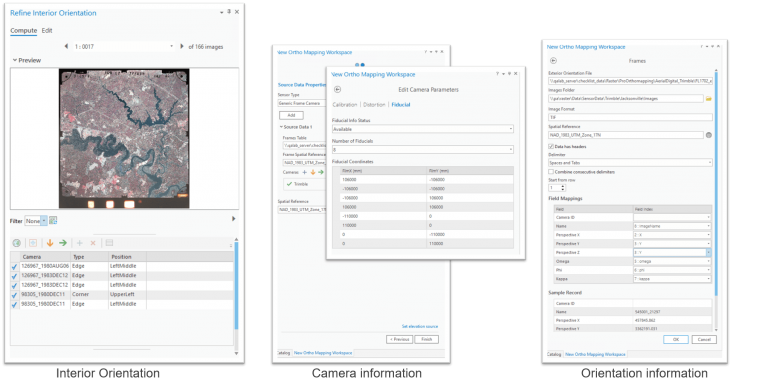
- Ortho Mapping [processing aerial images] – Frame and Camera table generation is now a guided step in Ortho Mapping Workspace Wizard as opposed to a manual process. Interior orientation for aerial scanned imagery can now be performed in ArcGIS Pro 2.3 and the UX supports multiple fiducial templates.
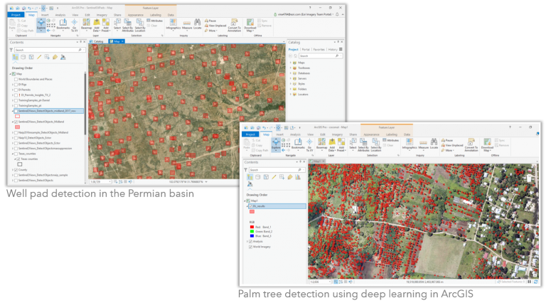
- Deep Learning and Image Classification – A Deep Learning toolset has been introduced to enable incorporating deep learning models directly into GIS workflows.
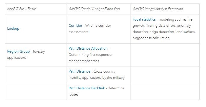
- Raster Functions – The list of raster functions – 7 new functions - with additional statistical operators and distance functions has been expanded.
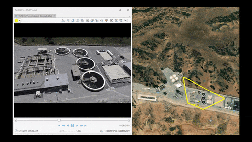
- Motion Imagery (Full Motion Video) – Full Motion Video is now Motion Imagery in 2.3. Motion Imagery enables the management and interaction with video that has embedded geospatial metadata. Hence, you can now create and edit features in the video player; update existing feature classes; display GIS layers; and extract metadata from both live video feeds and archived videos.
For a more complete discussion and additional resources on this topic, read Vinay Viswambharan’s blog to learn more.