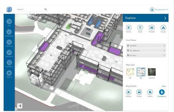
Esri Product Manager Nitin Bajaj said, “ArcGIS Indoors brings the interior building space into the future by placing data about employees, schedules, meetings, customers, and events into a geographic context.”
With ArcGIS Indoors, life will become much easier for employees, customers, travelers, and visitors since they will be able to see and share where assets, rooms, departure gates, and offices are located. The full version of ArcGIS Indoors will be available by the end of the year. Go here for more information and/or for notifications/information.
And, another new stuff which will further delight urban planners, city/municipal planning departments, and land developers (besides Esri’s CityEngine) is...
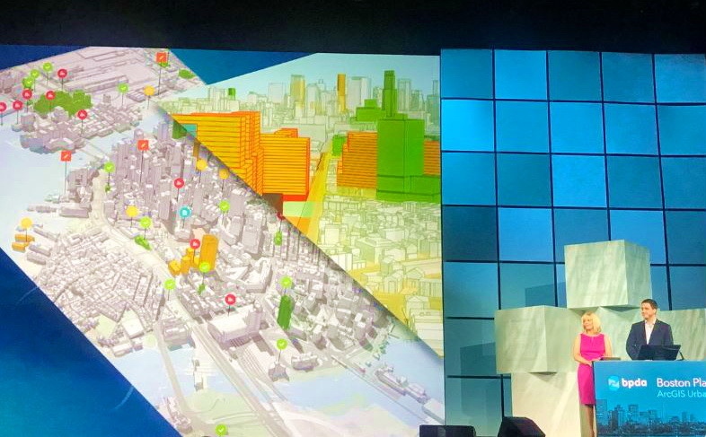
ArcGIS Urban, envisioned as an all-in-one system, combines real-world information with zoning rules and puts this into the hands of urban planners, city/municipal planning departments, land developers, and practitioners. It visualizes zoning codes, tracks project life cycles, measures the impacts of projects after completion, etc. It provides clear, color-coded 3D models of neighborhoods that can be navigated to see exactly what these requirements are, where they are enforced, and how they will inform current construction as well as future projects, resulting in a more economically prosperous, resilient and vibrant city.
ArcGIS Urban is also an immersive and collaborative solution for decision-making as it will eliminate many of the delays that occur when numerous teams are involved in a large-scale development project.
The Boston Planning & Development Agency (BPDA) have beta-tested ArcGIS Urban in evaluating new development projects in Boston. To see ArcGIS Urban in action, read Esri Brooks Patrick’ blog “Meet Boston’s Digital Twin”. Also, watch this video to get a sneak peek of ArcGIS Urban in this demo/presentation of city of Boston’s Planning & Development Agency at the Plenary of the #EsriUC last July 9 in San Diego.
In using ArcGIS Urban, Carolyn Bennett, BPDA’s GIS supervisor said “these new tools are putting powerful geospatial information into the hands of the city planners providing access to a digital twin of Boston with dynamic zoning data that can be used to support important planning initiatives and streamline the design review process.”
To stay updated on ArcGIS Urban release plans and development, go here.
Debuting also during the Plenary of the #EsriUC is...
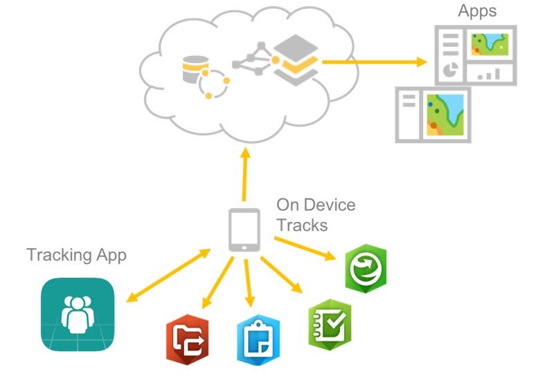
Location Tracking is a simple, lightweight location tracking app and designed for low battery use and efficiency. Mainly, it gives users the ability to share their current and previous locations while going about their work. It can also store tracks on your mobile device and makes it available to other ArcGIS field apps (i.e., Workforce, Collector, Explorer, Navigator, Survey123) and upload tracks to ArcGIS when connected.
Read Esri Jeff Shaner’s blog – “Location Tracking Debuted At Esri User Conference, July 2018” - as he describes much better what Location Tracking does. By the way, hold your horses as Location Tracking will be released in the second quarter of 2019 (that is next year) as a capability of both ArcGIS Enterprise and ArcGIS Online.
Another stuff unleashed during the Plenary of the #EsriUC is...
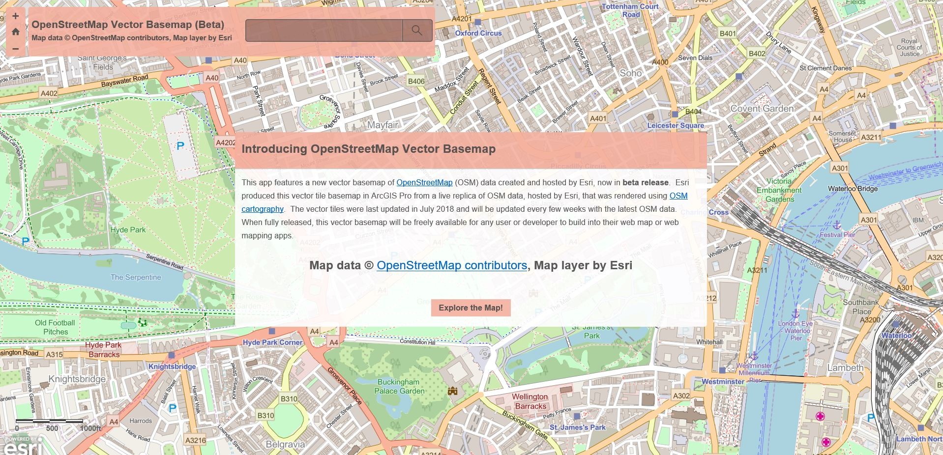
OpenStreetMap Vector Basemap
This stuff allows users to access all of OpenStreetMap as a vector basemap in ArcGIS Online (whereas before Vector BaseMap, the basemap references a raster tile service hosted by the OSM Foundation). With OpenStreetMap Vector Basemap, the map will be built using OSM data exclusively. . . AND, OpenStreetMap will be freely available to any user or developer that would like to use an OSM vector basemap in their map or app. Esri’s Deane Kensok has more about OpenStreetMap Basemap. Read his blog – “New OpenStreetMap Vector Basemap Available” - to learn more.
You can explore the new OpenStreetMap Vector Basemap that is available as new items (app, map, layer) in this ArcGIS Online group. You are free to share your feedback or questions in the comments and Esri will reply.
And for a peek into the future, you may want to see Esri’s ArcGIS Pro roadmap.
ArcGIS Pro Roadmap
Esri’s ArcGIS Pro Roadmap is meant to give you a sneak peek of what Esri is focusing on for the near, mid and long-term of ArcGIS Pro development. To navigate the roadmap, Esri would like its users to also voice out what they like to see in the next ArcGIS Pro. To share your ideas with Esri, go here to ArcGIS Ideas and here to learn more about the ArcGIS Pro Roadmap.
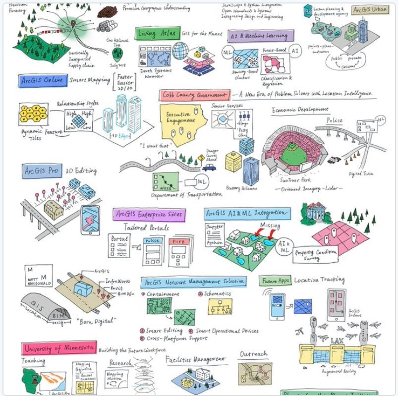
And, related to the ArcGIS Pro Road Map, you might want to know the BIG ideas being discussed at the 2018 #EsriUC. Check the “Big Ideas Poster” to get a sneak peak!
Waze + Esri

BIM + GIS
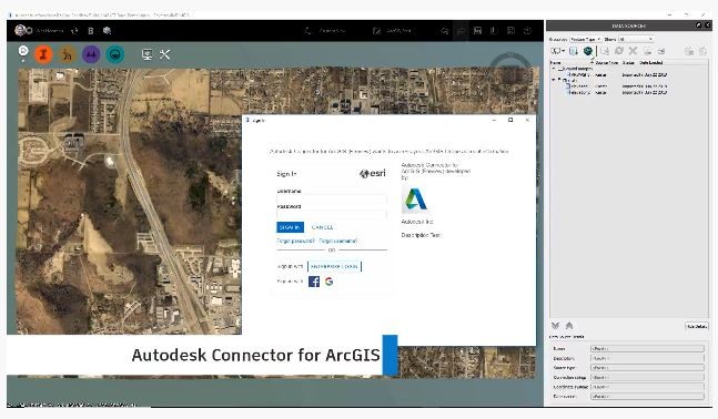
And while all of these were being unleashed in the #EsriUC, Autodesk announced exciting news related to BIM + GIS, a new stuff called the Autodesk Connector for ArcGIS for its latest InfraWorks! Autodesk said this is its initial step towards improved BIM + GIS workflows (if you recall, Esri and Autodesk announced their BIM + GIS alliance last November 2017). The connector is used to build an InfraWorks model directly from GIS data published to ArcGIS Online.
And that's it for July!