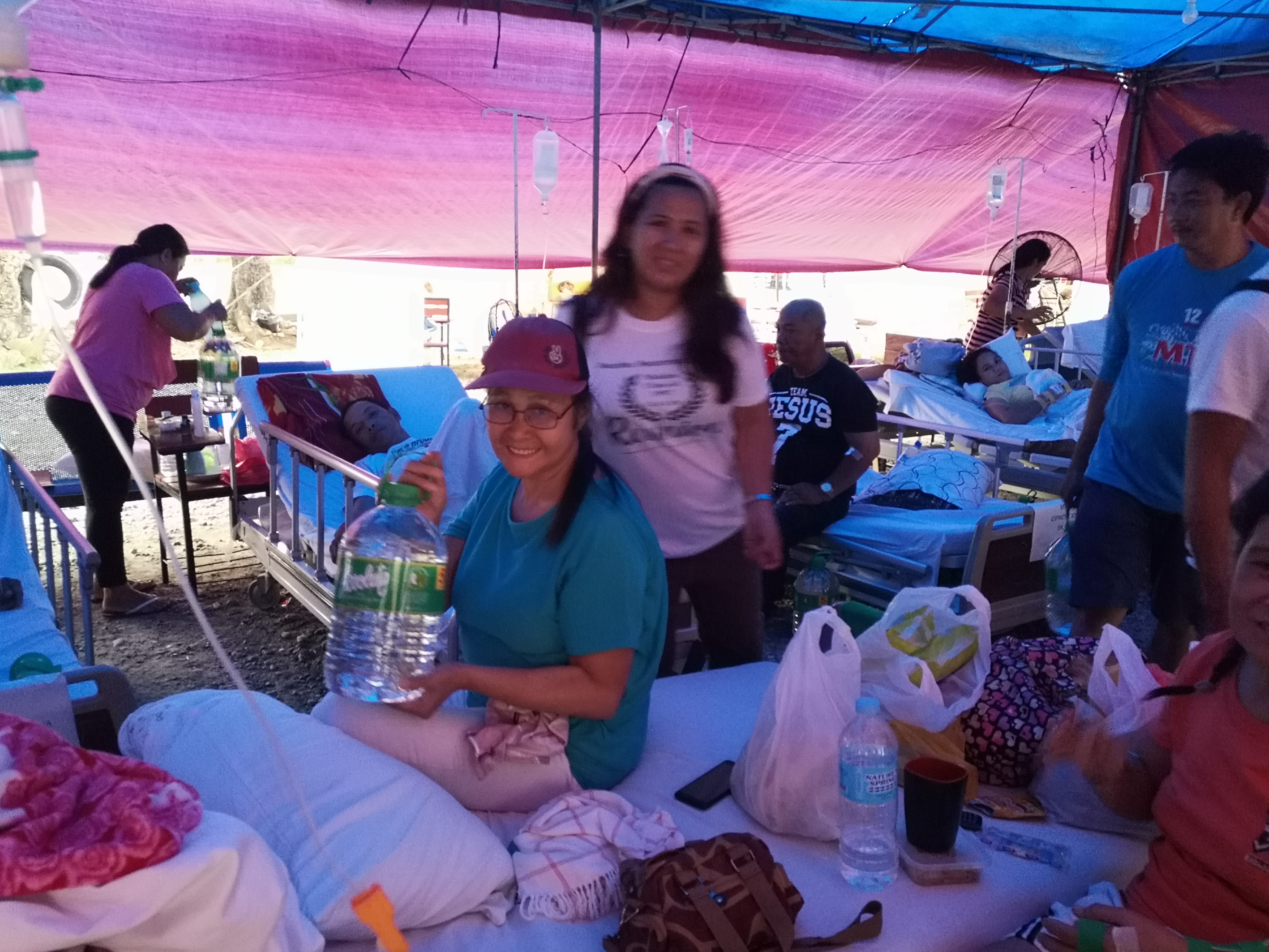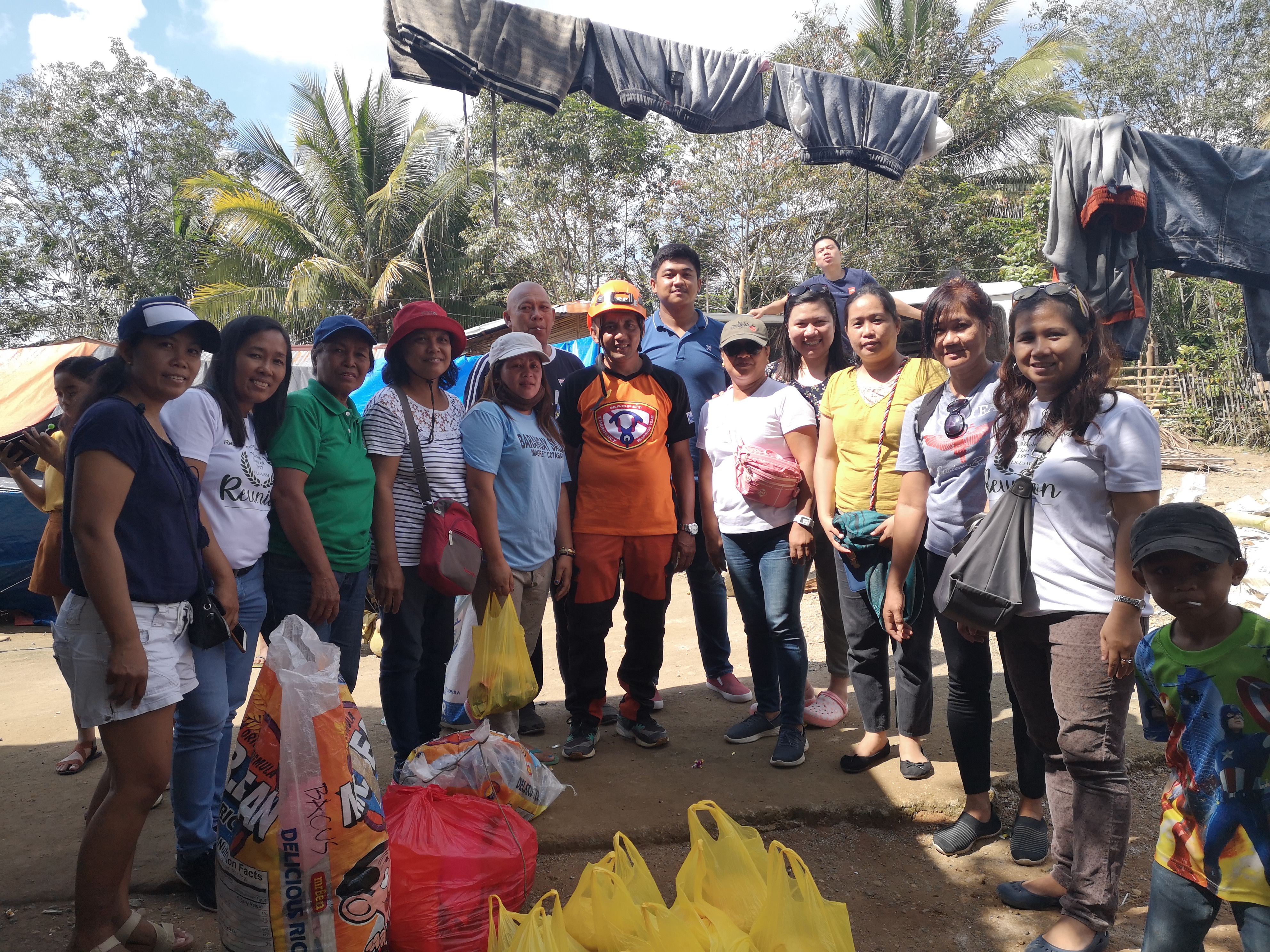
COTABATO Province. A few days after the 6.3 magnitude earthquake in this province, GEODATA SYSTEMS delivered a total of 545 relief goods packages directly to affected families in one (1) barangay of Tulunan municipality; one (1) barangay of Magpet municipality; and two (2) barangays of Makilala municipality.
GEODATA SYSTEMS’ Marites Espiritu coordinated the relief effort with the concerned barangay officials of Barangays La Esperanza, Sallab, Malasila and New Israel.
Also, 140 gallons of distilled water was likewise provided by GEODATA SYSTEMS directly to the Kidapawan Doctors Hospital and Makilala Medical Specialist Hospital.
As official distributor of Esri in the Philippines, GEODATA SYSTEMS also brokered with the Cotabato Provincial Government Esri’s assistance via its Disaster Response Program.
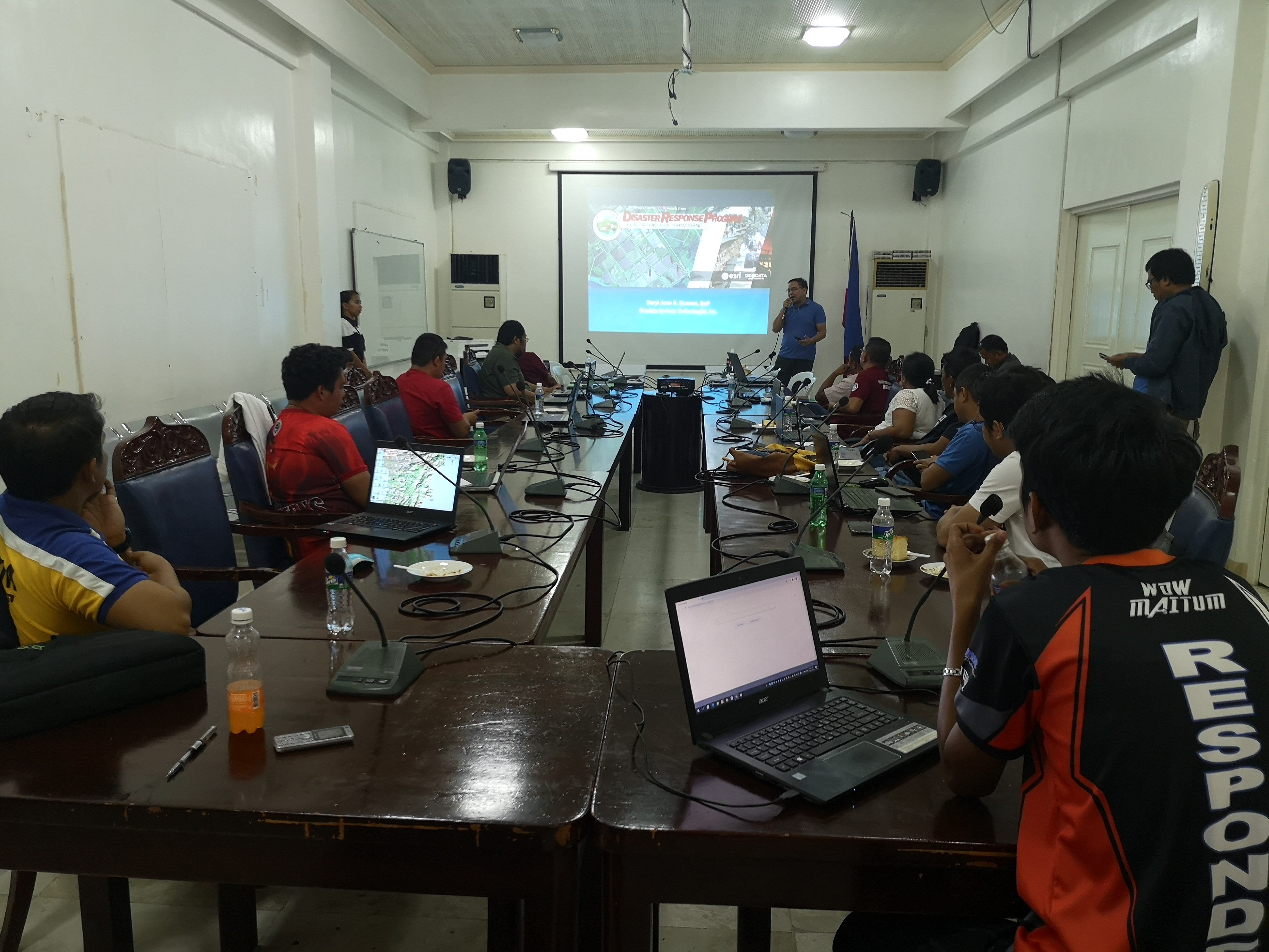
With Esri’s Disaster Response Program, Esri via GEODATA SYSTEMS provided the Cotabato provincial government data, software, configurable apps and technical support. With these, GEODATA SYSTEMS helped the Cotabato provincial government developed and implement an ArcGIS-based workflow for damage assessment, incident reporting and monitoring as well as provided ArcGIS trainings for personnel of the province’s PDRRMO and PPDO.
Esri’s Disaster Response Program provides assistance for an organization’s emergency GIS-based operations to rapidly access and visualize mission-critical information about the specific locations affected by a disaster.
Using ArcGIS field apps like Survey123, employees of the Provincial Disaster Risk Reduction and Management Office and the Provincial Planning and Development Office undertook assessment and monitoring activities using mobile devices in disconnected and disrupted barangays seriously affected by the earthquake.
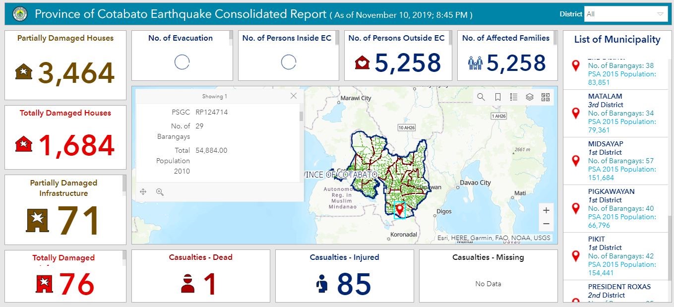
Among the outputs of the ESRI-GEODATA disaster response aid is the “Province of Cotabato Earthquake Consolidated Report” dashboard built using Operations Dashboard for ArcGIS. This dashboard is a web app which provides provincial officials location-aware data visualization and analytics for a real-time operational view of affected people, damages, evacuation centers, etc.