Nisso Moyal, Director of Business Development and Big Data at Mobileye said that “through this collaboration with Esri, we are able to provide a game-changing product to cities and mobility providers. By enabling direct uploading of geospatial events from Shield+ fitted to municipal buses and the like to Mobileye Smart Mobility Dashboard, cities will be able to anticipate and help prevent the next collision, while in general managing all of their assets much more efficiently.”
Similarly, Jim Young, Esri Head of Business Development said “Esri is excited to collaborate with Mobileye for an offering that brings us so much closer to creating safer communities. Making spatial data available to governments to improve safety and overall quality of life is an important step.”
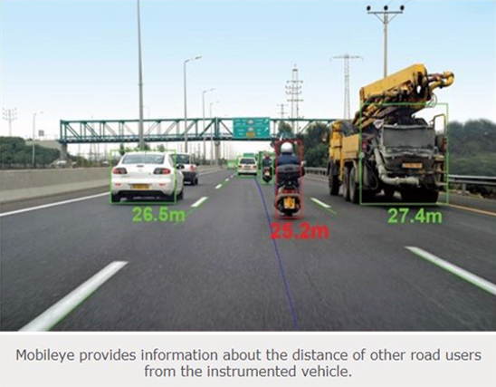
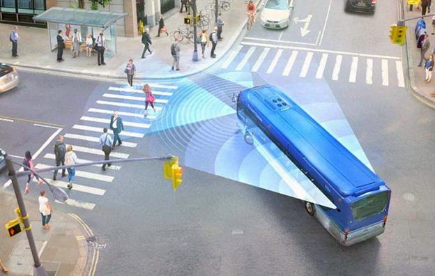
Under the Esri-Mobileye collaboration, ArcGIS will be integrated with Mobileye’s Shield+ product. Mobileye’s Shield+ will stream road safety data retrieved form city fleets into Esri’s ArcGIS platform, where information such as pedestrian and cyclist detection in blindspots can be viewed on the Mobileye Smart Mobility Dashboard. Shield+ alerts will be updated to the dashboard in real time, providing a city-wide view of pedestrian and cyclist safety. Among other things, this will allow users such as municipal bus drivers to then receive alerts about imminent hazards seconds before a potential collision, and to have a better, safer awareness of the roads they travel. As part of this collaboration, Mobileye will give municipalities entering into new contracts with it the option to incorporate the analytics-based capability powered by Esri ArcGIS.