Good news for the utilities sector! Esri has released the ArcGIS Utility Network Management extension as part of the ArcGIS platform. The release makes ArcGIS the world’s first complete utility GIS platform.
The extension lets users create, manage, and share complete data about networks from source to demand such as residential meters for electric, water, wastewater, gas, district heating, and telecommunication companies.
Further, the ArcGIS Network Management extension allows the utility network to be completely cross-platform capable. This means that it is not confined to users of desktop GIS software. Prior to this innovation, location data was not easily accessible for fieldworkers or executives, managers, service technicians, and accountants who needed to have accurate, real-time understanding of utility assets. (To learn more about the ArcGIS Utility Network Management, go here, and here.
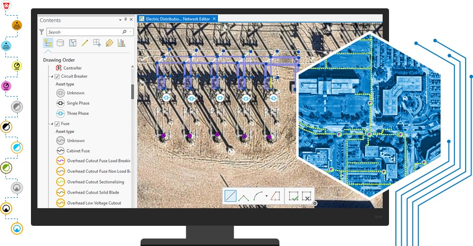
According to Esri, these network management capabilities provided by the ArcGIS Network Management extension enhance the ArcGIS platform for handling billions of data elements while providing access to the utility network on any device, anytime, anywhere. For the first time, workers of Maynila or Manila Water or PrimeWater, will be able to edit and trace the path of a network from a smart device while in the field and share information securely and more easily with those who need it. Previously, each utility subnetwork – like transmission lines, substations, and distribution and low-voltage networks – had its own separate GIS database.
Esri Global Director for Utilities and Communication Jeff Rashid said “these advanced capabilities will help utilities and telecoms provide greater details about their networks across their organization, at a rate of speed not seen in the past.”
Also, Jay Stinson, general manager of Schneider Electric Geospatial Business said “we are excited about the new capabilities in Esri’s utility network management platform and look forward to evolving the ArcFM Solution XI Series to offer unprecedented value. This next generation platform enables us to build a world class ecosystem for managing the design and construction workflow. The continued strength of the historic Esri and Schneider Electric partnership will help utilities realize the full potential of their GIS investment, equipping them to address the challenges facing today’s digital utility.”