Microsoft’s Tactical Edge Platform will use ArcGIS Enterprise to give its Microsoft Azure and Azure Cognitive Services a geographic context.
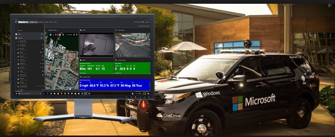
Tactical Edge Platform is intended to demonstrate to defense and intelligence professionals how they can use connecting field sensor data and cloud services for domestic emergency response, or for tactical field operations support in war theaters. This demonstration is displayed by deploying the platform in a fully operational car called the Tactical Edge Vehicle.
Lily Kim, General Manager , Azure Global at Microsoft said “Esri’s cloud-based platform enables networks of sensors to be analyzed geospatially, and coupled with Microsoft Azure Cognitive Services, allows for that sensor information to be analyzed around the clock supporting various roles from the edge to the intelligence centers. This delivers the type of data insights to customers in the field that they require to respond effectively in today’s fast paced world.”
Using the Tactical Edge Platform, soldiers or disaster response field personnel, coupled with mobile phones turned autonomous ground sensors, can capture the seen and unseen world around them with elements ranging from wireless infrastructure to photos of the population. From there, the data is transmitted to ArcGIS, residing in Azure and using Azure Cognitive Services to apply artificial intelligence to the collected data. The AI-processed results are then fused with ArcGIS’s spatial analytics, and become actionable across the ArcGIS platform, including pushing results forward into the tactical vehicle’s displayed ArcGIS Operations Dashboards. Operations Dashboards can be quickly created by anyone and custom built for all roles in a mission.
By using ArcGIS Enterprise in the Tactical Edge Platform, Tim Murphy, Director of Contextual Intelliegence at Esri said “Microsoft has provided a great opportunity for us to demonstrate the rapid deployment of our geospatial capabilities, providing both online and offline capabilities to our customers in disaster management and those forward supporting humanitarian and national defense missions alike. This new demonstration in the Microsoft Tactical Vehicle brings together how Esri’s technology can fully geo-enable tactical operations for real-time spatial awareness.”
Utilizing the open-standards of these commercial off-the-shelf (COTS) products immediately connects ArcGIS compatible partners through ArcGIS to Azure and can be utilized by the tactical vehicle. In this demonstration, it includes Knowledge Bridge International (KBI) for the sensor network, and Meemim’s vGIS utilizing Microsoft Hololens. Both KBI and Meemim are among the hundreds of Esri partners.